The KTA Store is changing homes
Shop at our new online storefront for the latest deals and products!
Click here to visit the new page.
Shop at our new online storefront for the latest deals and products!
Click here to visit the new page.
Shipping: All packages are shipped through the USPS. We work hard to make sure that every order is processed, shipped, and at your mailbox within 6 business days, often less. However, delays in shipment may be caused due to staff attending KTA events, programs, and meetings. If we expect a delay, a note will be posted here.
In-Person Orders: If you would like to skip the Shipping & Handling fee, please call 717-766-9690 to set up an appointment to shop our in-office store.
KTA GEAR

|
Keystone Trails Association Short Sleeve Tee
Gildan Adult Heavy Cotton™ T-Shirt is made of 5.3 oz., 100% preshrunk, sustainably and fairly grown USA cotton. |

|
|
Keystone Trails Association Logo Patch
Round; 3"; cloth; green and brown on white. |

|
|
Keystone Trails Association Logo Magnet
Round, 5 3/4"; exterior vehicle magnets. |
|
BOOKS, GUIDES, AND MAPS
|
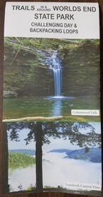
Trails in & around Worlds End State Park - by The Friends of Worlds End State Park
Worlds End State Park is a gorgeous, 780-acre park surrounded by the Loyalsock State Forest in northern Pennsylvania. With almost 100 miles of trails, this map explores a great many sites, with turn-by-turn guides to the most popular trails and features you'll see along the way. |
|
|
A Grip on the Mane of Life: An Authorized Biography of Earl V. Shaffer - by David Donaldson and Maurice J. Forrester
After serving four and a half years in the army during WWII-mostly in the battle-torn islands of the South Pacific-and along the way losing his best friend at Iwo Jima, Earl Shaffer came home to Pennsylvania with a large dose of military depression. After rattling around for a while he decided to act upon a prewar dream of hiking the entire Appalachian Trail, a decision that was spurred by reading a magazine article stating that such a feat was likely impossible. Earl achieved his goal, and history's muse presented him with a personal niche in her gallery. 1st edition (2014); 307 pages; black and white photos; paperback; 6" x 9". |

|
|
A Guide to the Edible and Medicinal Plants of the Finger Lakes Trail - by Heather A. Houskeeper
A hiker's practical guide to the plants found along the FLT and throughout New York State. (All plants also grow in Pennsylvania.) From Pisgah Press: Heather Houskeeper’s A Guide to the Edible and Medicinal Plants of the Finger Lakes Trail is a practical guide to identifying and utilizing the plants found along the almost 1,000-mile-long hiking trail. Houskeeper is an accomplished hiker and trained herbalist who was certified by the Chestnut School of Herbal Medicine in Asheville, NC. In 2015 she thru-hiked the Finger Lakes Trail and set the record as the first person to hike the entire FLT system, including its many side trails and byways, in one continuous trek. 1st edition (2016); 143 pages; color photos; spiral bound; 6" x 8". |

|
|
Foot Trails of the Moshannon and Southern Elk State Forests - by Ralph Seeley
This book contains descriptive trail guidance for the Quehanna Trail and the Allegheny Front Trail. It also describes the many other trails found in the Quehanna Wild Area, as well as the trails located in the Moshannon and southern Elk State Forests. In addition to details regarding the physical aspects of the trails, you'll also find plenty of extra information contained here. Historical insight and fellow hikers' stories add to the enjoyment and discovery of the trails in the Quehanna and Black Moshannon areas. 4th edition (2014); 132 pages; black and white photos; 5.5" x 8.3". |

|
|
Guide to the Allegheny Front Trail - 2nd Edition by Ben Cramer
The Allegheny Front Trail (AFT) is a 41.75 mile-long loop trail in Moshannon State Forest in western Centre County, Pennsylvania that roughly circles Black Moshannon State Park. Except for the short distance within the state park boundaries, the entire length of the AFT is within the state forest. This book by Ben Cramer provides detailed guidance on hiking the AFT. Turn-by-turn instructions, photos, and maps provide you with the information you need to enjoy the trail and the scenery of the Moshannon State Forest and the Allegheny Front. 110 pages; Dimensions: 6.5" x 4.5". |

|
|
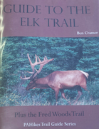
Guide to the Elk Trail - by Ben Cramer
The Guide to the Elk Trail is another in the PA Hikes series. This pocket-sized guide contains 55 pages describing the Elk Trail and the nearby Fred Woods Trail. Inside you’ll find turn-by-turn directions for this 15.6 mile segment trail near Benezette and information on local resources. Included is a 2-sided color map printed on water-resistant paper. (2016); 5.5” x 4.5”. |
|
|
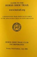
Guide to the Horse-Shoe Trail
A Pennsylvania trail from Valley Forge National Historical Park to the Appalachian Trail on Stony Mountain. 25th edition (2018); paperback. |
|
|
Guide to the Quehanna Trail - by Ben Cramer
The Guide to the Quehanna Trail is another in the PA Hikes series. This pocket-sized guide contains 151 pages describing the Quehanna Trail. Inside you’ll find turn-by-turn directions for this oval-shaped loop trail in the Moshannan and Elk State Forests. Included with the guidebook are 4 color maps (2 2-sided pages) showing the route of the trail, vistas, parking, and optional side trails. Elevation profile also included. (2016); 4.5” x 6.5. |

|
|
Hiking the Susquehannock Trail - by Ben Cramer
The Susquehannock Trail System (STS) is an 83 mile-long loop trail, plus several connecting trails, in North-Central Pennsylvania. The main STS is mostly in Potter County, one of the least inhabited areas of Pennsylvania, so the Susquehannock Trail System offers a special sense of remote solitude. Ben Cramer provides turn-by-turn directions in both miles and kilometers, as well as areas of poor or good water quality, and potential camping spots along the trail. Also included are elevation profiles and details on some of the side trails found here, including the West Branch Trail, East Fork Trail, North Link and South Link Trails. Guide is paperback, 264 pages, 6.0 x 4.0 x 0.6 inches. Maps measure 8.5" x 11", full color both sides, and printed on water proof paper. |

|
|
John P. Saylor Trail Guidebook
The John P. Saylor Trail Guidebook (2012) is the third in the PAHikes Trail Guide Series. This pocket-size trail guide contains 58 pages describing the John P. Saylor Trail. Inside you'll find turn-by-turn directions for hiking this double-loop trail located on the Allegheny Plateau. Included with the guidebook is a full color map. This map shows the route of the trail and indicates distances, parking areas, and points of interest. Trail Guide, 58 pages, 4.25" x 5.5". Map, 2-sided, full color, 8.5" x 11". |

|
|
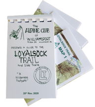
Loyalsock Trail Guide
The Alpine Club of Williamsport presents a guide to the Loyalsock Trail and side trails. Hand-assembled paperback with 3 water-resistant, color maps. 20th edition (2020); 51 pages; 3.75" x 5.75". |
|
|
Mason-Dixon Trail Maps
Complete set of ten (10) maps to the 199.4 miles of trail that make up the Mason-Dixon Trail System (2020); folded 4.5" x 8.5". |

|
|
Old Loggers Path Guide - by Dave Gantz
The Old Loggers Path (OLP) is a great walking path for beginner and experienced hikers alike. This looped trail explores the Loyalsock State Forest for 27.8 miles. In the updated second edition, you'll find turn-by-turn directions for hiking the trail, including recent reroutes and location of erected Adirondack style trail shelters, along with pictures and a brief description about the geology of the area. Included with the guidebook is a full color map. This map shows the route of the trail and indicates distances, elevation profile, parking areas, and points of interest (vista, shelters, etc.). Includes map, 2-sided, full color. (2020);8.5" x 11" |

|
|
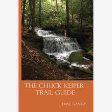
The Chuck Keiper Trail Guide - by Dave Gantz
The Chuck Keiper Trail Guide is another in the PA Hikes series. This pocket-sized guide contains 60 pages describing the Chuck Keiper Trail. Inside you’ll find turn-by-turn directions for this loop on the Allegheny Plateau, information about the area, geology, parking, and more. Included is a 2-sided color map printed on water-resistant paper. (2016); 4.5” x 6.5”. |
|
|
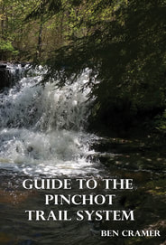
Guide to the Pinchot Trail System - by Ben Cramer
The Pinchot Trail is a 22 mile circuit trail in the Pinchot State Forest. The trail offers a little bit of everything that a hiker would want from a trail. Sheltered paths, a gurgling creek, a picturesque waterfall and a bog area which contain some plants not common to Pennsylvania. Turn-by-turn instructions, photos, and maps provide you with the most detailed information you need to venture out onto this trail. Included with this trail guide is a full color, water-proof map, measuring 8.5" x 11", printed on both sides, showing the north and south loops of the Pinchot Trail. |
|
|
Guide to the Golden Eagle Trail
This pocket size trail guide contains 28 pages of information and detailed directions on hiking the Golden Eagle Trail as well as the Bob Webber Trail. The trail guide also includes a map of both trails, printed on water proof paper. The maps shows hiking distance as well as points of interest along the trail. Map, 2-sided, full color, 8.5" x 11". Comes in waterproof container to help keep the trail guide as dry as possible on the trail. |

|
|
Guide to the Donut Hole Trail
The Donut Hole Trail (DHT) is one of Pennsylvania's longest, most remote, and least visited backpacking trails. At 94.17 miles in length, the DHT traverses Sproul State Forest with many challenging climbs and remote back-country segments that can be quite difficult to reach by car. In this guide, author Ben Cramer provides turn-by-turn directions for the trail in both miles and kilometres. You'll also find areas called out for poor or good water quality as well as possible campsites along the trail. The Guide to the Donut Hole Trail is a must have companion for exploring this rough and wild area of Pennsylvania. The guide book comes with two, full color maps (11" x 17"), printed on both sides of water-proof paper, showing the entire route of the DHT, along with side trails T-Squared and John Paulhamus/Garby trails. An elevation profile of the Donut Hole Trail is also provided. |

|
|
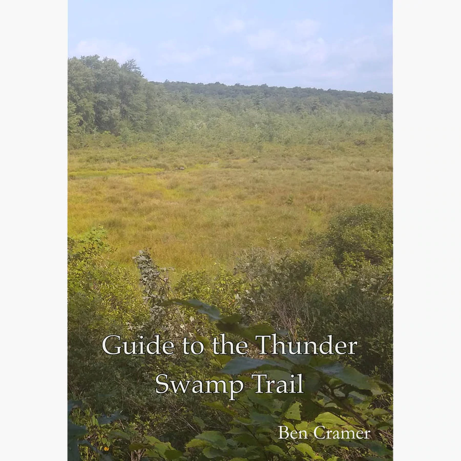
Guide to the Thunder Swamp Trail
The Thunder Swamp Trail traverses a segment of Delaware State Forest in southern Pike County, in the Pocono Mountains region of northeastern Pennsylvania. There are two trails that make of the Thunder swamp Trail: the "Main Loop" and the "Northeast Spur". This trail guide by Ben Cramer provides detailed guidance on hiking all of the Thunder Swamp Trail. Turn-by-turn instructions, photos, and a map provide you with the most detailed information you need to venture out onto this trail. Included with this trail guide is a full color, water-proof map, measuring 8.5" x 11", printed on both sides, showing the entire route of the Thunder Swamp Trail. |
|
|
Falls & Views Loop:
Exploring the Wildness of Worlds End State Park and Loyalsock State Forest Included is a 70-page guide book and three maps – all in full color. The first 18 pages provide general reference information concerning the park and forest – followed by over 50 pages of detailed turn-by-turn directions highlighting waterfalls, views, geological features, trail registers, water sources, and alternate routes. Local history is also highlighted – learn about the history of coal mining, railroading and the Civilian Conservation Corps here in Sullivan County among many other things.. |

|
MID STATE TRAIL GUIDEBOOK AND MAPS
|
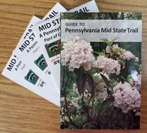
Guide to the Mid State Trail in Pennsylvania
The 13th edition (2018) is the latest release of this guide book, offering even more detail than presented in previous editions. The authors go to great lengths to tell something of the history of the areas you are hiking. New in this edition are elevation profiles. A quick glance and you'll know if you'll be facing a day of relatively flat hiking or an aerobic adventure of ascending and descending ridges. |

|
|
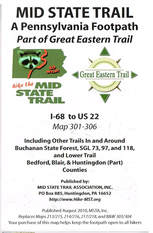
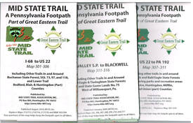
Mid State Trail Map 300-306: I-68 to US 22
Including other trails in and around Buchanan State Forest, SGL 73, 97, & 118, and Lower Trail. Bedford, Blair, & Huntingdon (Part) Counties. Published by Mid State Trail Association (2022). Replaces Map 301-306. |
|
|
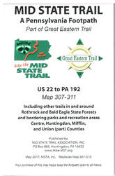
Mid State Trail Map 307-311: US 22 to PA 192
Including other trails in and around Rothrock & Bald Eagle State Forests & bordering parks & recreation areas. Centre, Huntingdon, Mifflin, & Union (part) Counties. Published by Mid State Trail Association (2017). Replaces Map 307-310. |
|
|
Mid State Trail Map 312-318: Poe Valley S.P. to Blackwell
Including other trails in and around Bald Eagle, Tiadaghton & Tioga State Forests; SGL 75 & 268. Union (part), Lycoming, Clinton, & Tioga (part) Counties. Published by Mid State Trail Association (2022). Replaces Maps 311-316, T17, T18. |

|
|
Mid State Trail Map Package
Includes all three maps as described above. |
|
|
Mid State Trail Map and Guide Set
Included in this map and guide set is the completely revised 13th (2018) edition of Guide to the Mid State Trail in Pennsylvania, along with color maps of the trail. |
|
TUSCARORA TRAIL GUIDEBOOKS AND MAPS
|
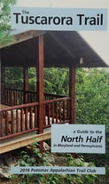
The Tuscarora Trail, A Guide to the North Half in Maryland & Pennsylvania
7th edition (2020; 104 pages; 4.25" x 7". |
|
|
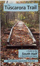
The Tuscarora Trail, A Guide to the South Half in West Virginia and Virginia
7th Edition (2020); 144 pages; 4.25" x 7". |
|
|
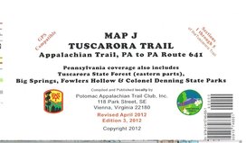
Tuscarora Trail Map J (Sections 1-5)
Appalachian Trail Junction in PA to PA Route 641. Pennsylvania coverage also includes Tuscarora State Forest (eastern parts), Big Springs, Fowlers Hollow & Colonel Denning State Parks. GPS compatible. 3rd edition (2012); multi-colored, on heavyweight waterproof stock; 17" x 32", folded to 4" x 8.5"; elevation profile. |
|
|
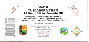
Tuscarora Trail Map K (Sections 6-10) PA Route 641 to Hancock, MD. Pennsylvania coverage also includes Buchanan State Forest (eastern parts), Cowans Gap State Park & Great Eastern Trail. GPS compatible. 4th edition (2013); multi-colored, on heavyweight waterproof stock; 17" x 32", folded to 4" x 8.5"; elevation profile. |
|
PENNSYLVANIA APPALACHIAN TRAIL GUIDEBOOK AND MAPS
|
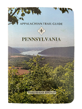
Appalachian Trail Guide - Pennsylvania
Includes detailed trail descriptions with tables of distances for all 230.2 miles of the Appalachian Trail located within the borders of Pennsylvania. 13th edition (2023); black and white photos; paperback; 207 pages; 4.5" x 6.5". |
|
|
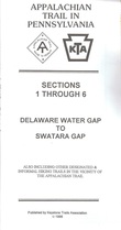
Pennsylvania Appalachian Trail Map Sec. 1-6: Delaware Water Gap to Swatara Gap
Delaware Water Gap to Swatara Gap. All maps show route of AT with elevation profiles, side trails, and other general information. Published by Keystone Trails Association, (2010); multi-colored, on heavyweight stock; folded 4" x 8". |
|
|
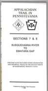
Pennsylvania Appalachian Trail Map Sec. 7-8: Swatara Gap to Susquehanna River
Swatara Gap to Susquehanna River. All maps show route of AT with elevation profiles, side trails, and other general information. Published by Keystone Trails Association, (2004); multi-colored, on heavyweight stock; folded 4" x 8". |
|
|
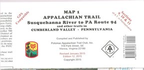
Pennsylvania Appalachian Trail Map Sec. 9-11: Susquehanna River to PA Route 94
Susquehanna River to PA Route 94 and other trails in Cumberland Valley, PA. All maps show route of AT with elevation profiles, side trails, and other general information. Compiled and Published by Potomac Appalachian Trail Club. GPS compatible. 12th edition(2015); multi-colored, on heavyweight stock; folded 4" x 8.5". |
|
|
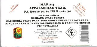
Pennsylvania Appalachian Trail Map Sec. 12-13: PA Route 94 to US Route 30
PA Route 94 to US Route 30 and other trails in Michaux State Forest, Caledonia State Park, Pine Grove Furnace State Park, Kings Gap Environmental Education & Training Center, PA. All maps show route of AT with elevation profiles, side trails, and other general information. Compiled and Published by Potomac Appalachian Trail Club. GPS compatible. 12th edition(2013); multi-colored, on heavyweight stock; folded 4" x 8.5". |
|
|
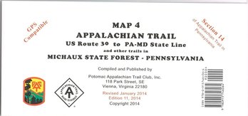
Pennsylvania Appalachian Trail Map Sec. 14: US Route 30 to PA-MD State Line
US Route 30 to PA-MD State Line and other trails in Michaux State Forest, PA. All maps show route of AT with elevation profiles, side trails, and other general information. Compiled and Published by Potomac Appalachian Trail Club. GPS compatible. 11th edition(2014); multi-colored, on heavyweight stock; folded 4" x 8.5". |
|
|
Appalachian Trail Guidebook and Maps - COMPLETE SET
The complete set includes the guidebook and all five maps as described above. |

|
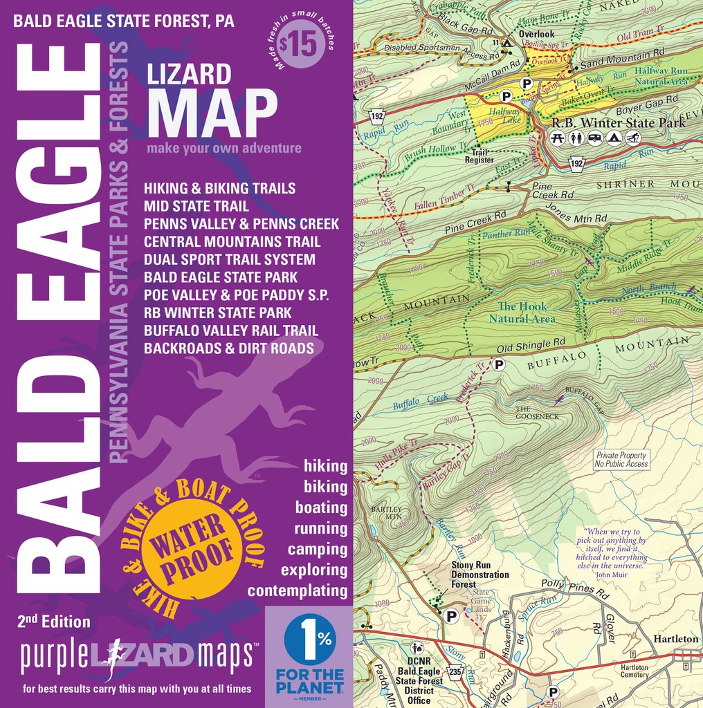
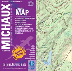
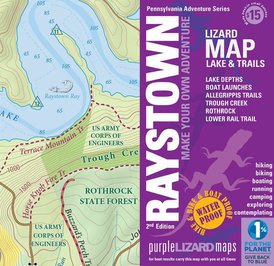
PURPLE LIZARD MAPSPurple Lizard Maps is dedicated to making beautiful maps of special places. Designed for those who want to make the most of their outdoor recreation, Purple Lizard's expanding line of "Lizard Maps" includes some of the best hiking destinations in Pennsylvania. The maps are waterproof, durable, and easily fit in your back pocket or backpack. Folded size 4" x 8". Lizard Maps offer hikers all the info they need for short or long distance adventures, including elevation, camping info, and contour lines.
Find Purple Lizard's "PA Adventure Series" below: |

|
|
Bald Eagle Lizard Map, 3rd edition
|
|
|
Michaux Lizard Map, 2nd edition
|
|
|
Moshannon-Quehanna Lizard Map, 2nd edition
|

|
|
Pine Creek Lizard Map, 2nd edition
Temporarily Out of Stock
|

|
|
Raystown Lizard Map, 2nd edition
|
|
|
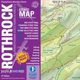
Rothrock Lizard Map, 7th edition
|
|
|
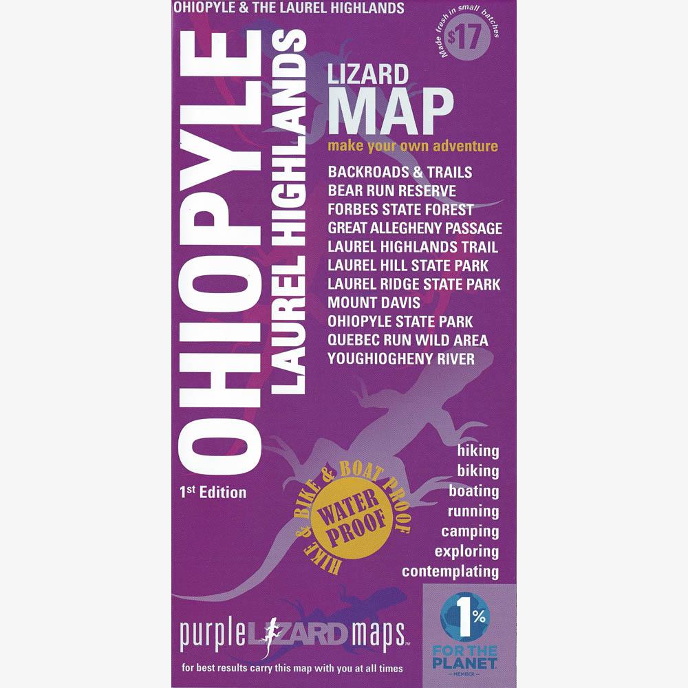
Ohiopyle-Laurel Highlands Lizard Map, 1st edition
|
|
|
Loyalsock-Worlds End Lizard Map, 1st edition
|

|
PATCHES
|
Golden Eagle Trail Patch
Oval; 3'; cloth; five colors. |

|
|
Allegheny Front Trail Patch
Round; 3'; cloth; nine colors. |
|
|
Black Forest Trail Patch
Round; 3"; cloth; seven colors. |

|
|
Chuck Keiper Trail Patch
Round; 3"; cloth; six colors. |
|
|
Donut Hole Trail Patch
Round; 3"; cloth; four colors. |

|
|
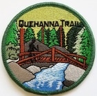
Quehanna Trail Patch
Round; 3"; cloth; ten colors. |
|
|
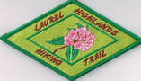
Laurel Highlands Trail Patch
Diamond; 5" x 3"; six colors |
|
|
Old Loggers Path Patch
Round, 4"; cloth; five colors. |

|
|
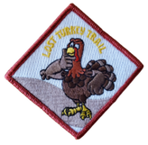
Lost Turkey Trail Patch
Diamond, 3.5"; cloth; six colors. |
|
|
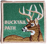
Bucktail Path Patch
Square, 3"; cloth; six colors. |
|
|
Patch Package
All 11 patches - 1 great price! KTA Logo, Quehanna Trail, Chuck Keiper Trail, Donut Hole Trail, Old Loggers Path, Black Forest Trail, Laurel Highlands Trail, Allegheny Front Trail, Golden Eagle Trail, Lost Turkey Trail, and Bucktail Path patches. |

|
|
Hike Beautiful Pennsylvania Sticker
NEW Hiking Boot, 3" This snazzy new sticker is a great way to show your pride in exploring Pennsylvania’s oh so beautiful hiking trails, and support KTAThe sticker communicates well what KTA’s community already knows: Pennsylvania is the place for hiking. Be sure to check out the full line of products from RepresentPA.com – all designed to celebrate our magnificent commonwealth. |

|
Interested in purchasing a map or trail guide not listed in our online shop? Please contact us at ktaadmin@kta-hike.org, and we'll be happy to help as much as possible.
Prefer to pay with check or money order? Please download the Mail Order Price List and print and complete the Order Form. Order forms can be mailed with your payment to: KTA, 46 E. Main St., Mechanicsburg, PA 17055.
Live nearby? Visit our office and make a purchase (cash or check accepted). Call in advance, please: 717-766-9690.