Standing Stone Trail
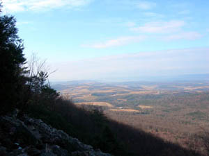
 Stone Valley Vista located just above Greenwood Furnace State Park
The 80-mile Standing Stone Trail (formerly known as the Link Trail) traverses the ridge and valley region of south-central Pennsylvania. It connects the Mid State Trail and Tuscarora Trail, and it is a component of the Great Eastern Trail network.
The SST is maintained by Standing Stone Trail Club. The trail’s name derives from a tradition among the region’s Native Americans to maintain tribal genealogies on a “standing stone” displayed in each village. In 2007, the former Link Trail Club changed the name of the club and the trail to the more historically poetic Standing Stone.
The SST is maintained by Standing Stone Trail Club. The trail’s name derives from a tradition among the region’s Native Americans to maintain tribal genealogies on a “standing stone” displayed in each village. In 2007, the former Link Trail Club changed the name of the club and the trail to the more historically poetic Standing Stone.
The northern end of the SST is at the Mid State Trail in Detweiler Run Natural Area in northern Huntingdon County, thanks to the annexation of the former Greenwood Spur Trail in 2014. The SST passes through Greenwood Furnace State Park. It then follows the tops of Stone Mountain and Jacks Mountain for a considerable distance, until descending the famous Thousand Steps historical monument near US 22. Continuing to the south, the SST walks through the towns of Mapleton and Three Springs, with more rugged ridgetop hiking between. Near its southern end, the SST uses an underpass at the Pennsylvania Turnpike and ends at Cowans Cap State Park, at a junction with the Tuscarora Trail. Note that some segments of the SST near its southern end are closed during hunting season.
Standing Stone Trail Club offers free high-resolution maps of the SST at its website.
Standing Stone Trail Club offers free high-resolution maps of the SST at its website.

